Additionally, the second free add-in Map.XL has exceeded 5,400 installations. I think it’s a good time to look back and summarize. In February 2016, the first version of the GIS.XL add-in was released. The add-in is publicly available for 3 years. Several updates have been gradually released and currently it is possible to install the 2.0 version.
Add-in GIS.XL has become the most successful commercial tool I’ve ever created. Customers are coming from all over the world. It belongs to the group of tools focused on hydrology, hydrogeology and data science - HydroOffice. Add-in basically forms a tool “in the middle” - between a simple spreadsheet and professional GIS solution. Its users can be divided to two general groups.
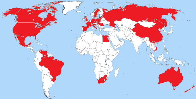
GIS.XL Customers
The first group is Excel users who work with spatial data, have no experience with GIS solutions and need to use some of their features such as spatial analysis / visualization or spatial data import / export. These users are most often in marketing or healthcare field.
The second group is GIS professionals who are experienced users of various GIS tools. For them, the add-in is an extension that allow to work with spatial data directly in Excel. As they work with these data on a daily basis, it streamlines and accelerates their day-to-day work.
Add-in GIS.XL is therefore a tool between classic spreadsheet interface and the GIS interface. It combines these two basic approaches to working with spatial data. It can not be considered as a full-featured and comprehensive GIS tool. This is a common misconception of his position, mainly between GIS professionals.
Thanks to the fact that the GIS interface contains only the most important features, it is relatively quick and easy to adopt it for Excel users, for which it represents the first step into the GIS universe. This understanding is shared by customers.
I will continue to develop and support this tool in the future. In the next versions of the program, I plan to expand the options of integrating with other tools or services and I plan to add the geocoding features.
In addition, at the current time I release a completely new tool called Reshape.XL. This tool is designed to speed up and streamline the data processing in Excel - data wrangling. I recommend you to look at this newcomer.