The current version of GIS.XL allows you to work with two GPX data types – trackpoints and waypoints. Waypoints are a set of individual points that are defined by GPS coordinates and other descriptive data. In contrast, trackpoints describe a track made of at least one track segment – ordered list of points describing a path. The full specification is posted on topografix.com. The work with GPX files is simple and straightforward. Practical example is shown in the following video.
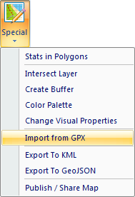
As can be seen from the video, import of GPX files is solved by clicking the function Special – Import from GPX. Then simply select the GPX file in the disk and the rest is done automatically by the program. Add-in parses the file and imports waypoints or trackpoints into the Excel.
From imported data are created two layers of points in the Map Panel. Layer names are defined as "filename" and "_trackpoints" or "_waypoints" suffix. After this step, you can work with data. With additional add-in functions, you can export selected GPX data into a spreadsheet (GPX to XLS), to GIS (GPX to SHP), publish it as an online map using the Leaflet.js library (GPX to Leaflet), export it to KML file for display in Google Earth (GPX to Google Earth / GPX to KML) or export it to GeoJSON file (GPX to GeoJSON) for further use.
If you have read it here, you may ask why not to use other tools prepared for these purposes. I think everything is about your workflow and effectivity. As a base you need a tool for work with tables. In the case, you are not a data scientist working fluently in R/Python, your basic tool is Excel. Imagine the case you need data from GPX files. In the first step you use one application for data export from GPX to CSV. Then you open CSV file in Excel for cleaning and processing. The next step is to export data from Excel to a file format that is readable in the following step. The last step can be processing in GIS (GPX to SHP), displaying in Google Earth or publishing online. Without GIS.XL add-in or professional tools such as R or Python, you need to use a number of applications. In the case you use GIS.XL, you can do all these steps in one familiar environment - Excel. In the long-term run, this integration will save you a lot of time that can be used more meaningful.