How to Intersect ShapeFile Layers
A further interesting feature is hiden under the
Special – Intersect Layer button. Imagine again,
that you want to cut some items out of your existing
rivers and streams map. For example, you want to
cut all rivers and streams in one district from your
complete rivers and streams map; and you have the
district you want to cut ready in a polygon in another
Map Layer.
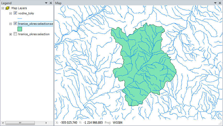
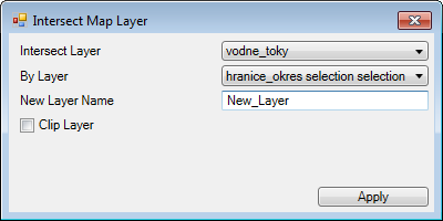
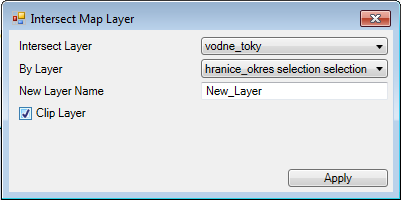
Clicking on the defined Intersect Map Layer button
displays the dialog below. Choose the layer you
want to cut in the first Intersect layer combo-box.
Select your polygon in the By Layer box and type
the new layer name in the New Layer Name box. Be
careful here, because if you leave the Clip Layer
box empty, add-in will select all the rivers that
fall within the polygon, but it will not crop them
along the polygon edges if they exceed the polygon
area.
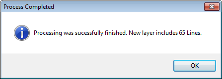
Finally, click Apply, and add-in processes the function, and advises you the number of features in your new layer; as below.
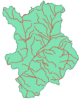
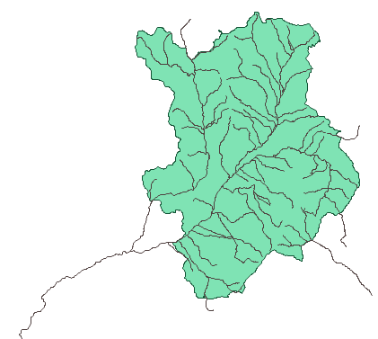
The result of your defined function is also shown in the following figure.
If you want to crop the rivers and streams along the
edges of the polygon, check the Clip Layer combo-box
in the dialog.
The river and stream lines are now trimmed at the polygon edges; as shown in the following figure.