User Interface of GIS.XL Add-in
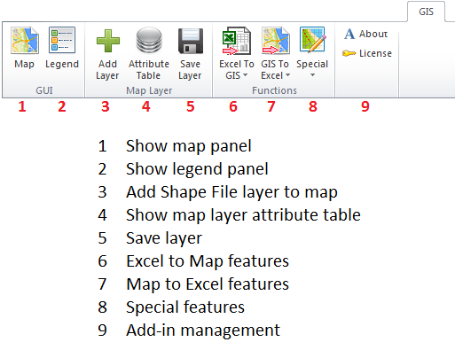
The GIS.XL add-in user interface has three main parts. The first is the ribbon
toolbar tab, named GIS. This toolbar contains everything you need to work with
add-in. The first two buttons display the map and legend panels. The second
group of buttons is used to work with external map layers in the ShapeFile
form and the third group is for working with spatial data. Using these functions,
you can combine the powerful features of Excel spreadsheet and GIS interface.
Finally, the last two buttons display information about add-in and commercial
license activation / deactivation.
These individual functions on the ribbon toolbar are described in the following
manual sections. Only the first two buttons are important in this chapter. The
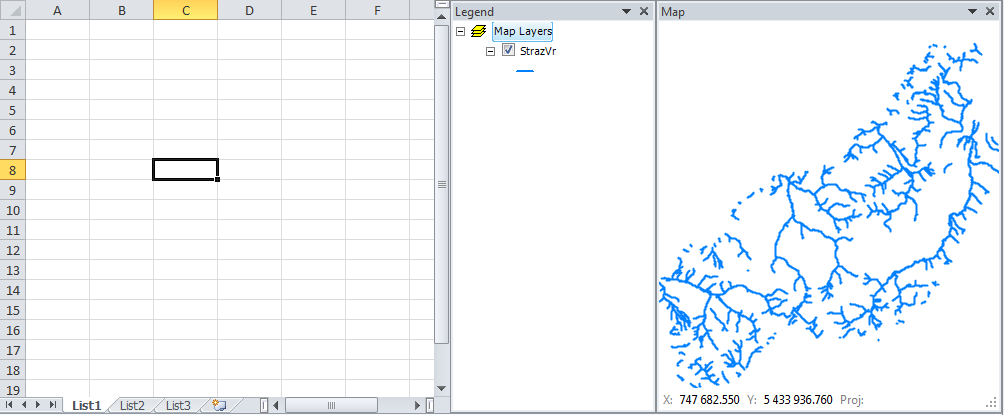
first button, called Map, displays the Map panel. This panel shows your data in
the form of maps, and you can import your data from the Excel table into this
panel and open external layers from ESRI ShapeFiles (*.shp). The panel is anchored
to the right part of the Excel window, but you can change its position. You
can exclude it entirely from the Excel window, move it on the external monitor or
resize it to fullscreen mode. The info bar in the bottom of the Map panel displays
the X and Y coordinates on the mouse cursor and also the coordinate system you are using.
If you want to change the map layers’ visual properties, you use features in the panel
which appear when you click the second ribbon button Legend. Invidual features of the
GIS interface are described in the following chapter.